Skip to content
  • Buy
  • Support
  • Contact
  • Login
Remote GeoSystems Logo - Black
  • Software
        • GEOSPATIAL VIDEO, PHOTO & DATA REMOTE SENSING SOFTWARE
        • Geotag, Map, Edit, Report, Share & Manage Geospatial Full Motion Videos, Photos and Other Metadata from Inspection, Patrol, Survey & Surveillance Operations

        • LineVision Desktop
        • LineVision Online
        • LineVision Google Earth Extension
        • VIDEO GEOTAGGING & EDITING SOFTWARE
        • Geotag Video, Interactive Map-based Playback & Geospatial Video Editing

        • Video GeoTagger
        • Video GeoEditor
        • Get Started

        • Buy Software
        • Free Trial
        • Request Demo
        • Account Login
        • Software Resources

        • Videos
        • User Manuals
        • Sample Data
        • Featured Software

          LineVision Online
        • LineVision Online
          Now available in hosted Professional and Team Editions as well as on-premise Enterprise deployments.

          LEARN MORE >

  • Recorders
        • GEOSPATIAL DIGITAL VIDEO RECORDERS
        • Record Georeferenced Full Motion Video & Audio with Continuous GPS & Other Important Project Metadata with our Patented geoDVR™ Systems.

        • geoDVR Gen4 /2
        • geoDVR Gen3
        • geoDVR Tablet
        • geoDVR Mini
        • geoDVR Installations
        • GEOSPATIAL DIGITAL SOUND RECORDER
        • Record Georeferenced Audio-only Files with Continuous GPS & Other Important Project Metadata with Our geoDSR™ Systems.

        • geoDSR Tablet
        • OPTIONAL MODULES
        • Enhance your geospatial video and audio data collection capabilities with our optional geoDVR & geoDSR modules.

        • Live Moving Maps
        • Camera Target Footprint
        • MISB FMV Metadata
        • Drill Down Waypoint Descriptions
        • Asset Management & Mission Alerting
        • Live Video & GPS Streaming
        • DSLR Camera Geotagging
        • Gimbal Camera Geo-Pointing
        • Nikon Camera Control
        • Featured geoDVR

          Front View of the geoDVR Gen4 /2 Geospatial Full Motion Video Recorder with the Start/Stop Recording and Waypoint Switch
        • New geoDVR Gen4 /2
          Offering professional 4K UHD & HD geospatial full motion video recording – Ideal for multi-camera data collection platforms.

          LEARN MORE >

  • Platforms
        • Data Collection Platform Solutions

          Our professional geoDVR video recording systems and integrated LineVision software options are ideal for airborne, drone, vehicle, rail & marine survey mapping and surveillance data collection platforms.

        • Aircraft
          • Aerial Power Line Inspection
          • Aerial Pipeline Patrol
          • Aerial Public Safety
          • Aerial Environmental Survey
        • Drones & Unmanned Systems
          • DJI Video Mapping Solutions
          • Drone Utility Inspection Solutions
        • Marine
          • Subsea ROV
          • Surface Vessel
        • Vehicle
          • Mobile Mapping
          • Tactical
        • Rail
        • Featured Installation

        • Ballard Marine Construction
          geoDVR Gen3 for recording georeferenced video from a VideoRay subsea ROV.

          LEARN MORE >

  • Solutions
        • Professional Services

        • Product Training
        • Geospatial Consulting
        • Video Software Development
        • Technology Capabilities

        • GoPro Video Mapping Software
        • DJI Video Mapping Software
        • Esri ArcGIS Platform Solutions
        • Gimbal Camera Solutions
        • Featured Solution

          LineVision GPS Video GIS Mapping Software
        • DJI Drone Software
          Offering professional video and photo mapping software for DJI drone survey and inspection projects.

          LEARN MORE >

  • Company
    • About
    • Patents
    • Events
    • Careers
    • Press Releases
    • In the News
    • Codes for Government Buyers
    • Legal

To enable .SRT file logging, in the DJI Go App, choose the MENU option on the right side of the screen for Images and Video.

Choose the Video icon and change file type from .MOV the default to .MP4.

Choose the Option tool icon and turn ON Video Caption. With that option turned ON, the .SRT files should be saved along with the .MP4 video file on your SD card when you record during a flight.

More DJI Articles

Check out related DJI articles, news and product updates from Remote GeoSystems.

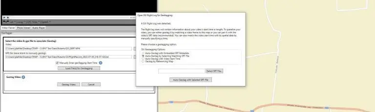
Geotag DJI Drone Video with Flight Record Log .TXT & .SRT Files

Read More >
Press Release Banner Image - LineVision Online DJI Drone FOV FMV Video Support

Remote Geosystems Updates LineVision Online Enterprise with Enhanced Support for DJI Drone Full Motion Video Camera Metadata and Field of View Mapping in the Cloud

Read More >
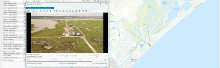
How To Banner Image - DJI Drone Video MISB FMV STANAG 4609 ArcGIS Pro

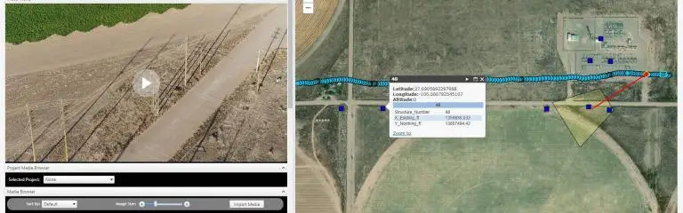
Camera Target Footprint (CFT) Video Support for DJI Drones

Read More >

How To Save Video GPS Track as a CSV Compatible with Esri’s FMV Multiplexer

Read More >

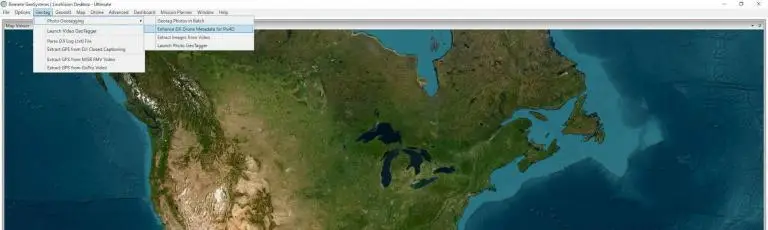
Enhance DJI Photos & Video Frame Grabs for Faster Pix4D Processing

Read More >

Retrieve the Flight Record Log File from DJI Drones

Read More >
PrevPreviousRemote GeoSystems LineVision Esri Applications Now Available in the ArcGIS Marketplace, Company to Exhibit and Present at the Esri UC Solutions Expo
NextRemote GeoSystems Donates LineVision Software to Official Drone Operators for Hurricane Harvey and Irma ResponseNext
Remote GeoSystems Logo - Black
Linkedin Youtube Facebook
Esri Partner Logo - Bronze
  • COMPANY
  • About
  • Patents
  • Press Releases
  • In the News
  • Newsletter
  • Legal
  • SOFTWARE
  • LineVision Desktop
  • LineVision Google Earth
  • LineVision Online
  • Video GeoTagger
  • Video GeoEditor
  • RECORDERS
  • geoDVR Gen4
  • geoDVR Gen3
  • geoDVR Tablet
  • geoDVR Mini
  • geoDSR Tablet
  • PLATFORMS
  • Aircraft
  • Unmanned
  • Marine
  • Rail
  • Vehicles
  • GET STARTED
  • Buy Software
  • Free Trial
  • Get Support
  • Request a Demo
  • geoDVR Quote
  • geoDSR Quote

3307 South College Avenue | Suite 211 | Fort Collins, Colorado 80525 | USA

© 2011 – 2026 Remote GeoSystems, Inc. | All Rights Reserved | Pat. www.remotegeo.com/patents