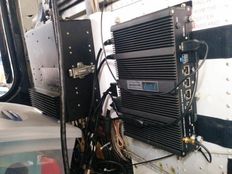
FORT COLLINS, Colorado / CHESAPEAKE, Virginia, USA – Remote GeoSystems, Inc. and Chesapeake Bay Helicopters, Inc. (CBH) are pleased to announce the successful implementation of the geoDVR Gen2 with a FLIR Corona 350 Gimbal Video Camera System on a MD Helicopter for Airborne Utility Line Inspections.
“The geoDVR offers tremendous advantages over our previous video recording system,” says Chesapeake Bay Helicopters CEO & Co-Owner Manager Oleg Bulanov. “The geoDVR is a fraction of the size and weight, it records all three video channels to a single SDD, and offers user-friendly multi-stream video monitoring. The in-mission GPS logging and post-flight reporting software means CBH can provide our clients with vital inspection information in hours, not weeks.”
The geoDVR Gen2 is an advanced “plug & play” DVR for recording multiple channels of geo-referenced High-Definition Full Motion Video (gFMV™) in airborne and mobile mapping environments. It is ideally suited for professional utility/pipeline inspection, ISR and law enforcement applications that utilize multi-sensor gyro-stabilized gimbal video cameras.
Chesapeake Bay Helicopters will use the geoDVR with their FLIR Corona 350 to perform helicopter-based electric utility inspections with High-Definition color (EO), Infrared (IR) and Corona (UV) video as well as high-resolution oblique still photos.
Videos, photos, points of interest and audio notes collected with the geoDVR are compatible with Remote GeoSystems LineVision™ suite of GIS project mapping and reporting software. LineVision allows for simple desktop and browser-based playback, analysis and project reporting utilizing the Esri ArcGIS Platform, Google Earth, Bing Maps & PLS-CADD.
About Chesapeake Bay Helicopters, Inc.
Chesapeake Bay Helicopters, Inc. (CBH) Incorporated in 1998 and is a leader in providing technology-based, diversified commercial services and asset reliability support for utility & gas companies across the US.
CBH Currently Offers the Following Airborne Services:
Helicopter Based Power Line Maintenance and Construction Work
Gyro-stabilized Infra-red and Corona Inspection & Reporting Services
LiDAR, Nadir and Oblique Image Collection (for Nationwide Utility Projects)
In-house, Technical Data Processing (LiDAR and Ortho-imagery)
Geospatial Full Motion Video Capture & Integrated GIS Software Solutions
Natural Gas Leak Detection Services
Equipment Rentals
Learn more at www.cbhelos.com
###
More Articles & News
Check out related articles, news and product updates from Remote GeoSystems.


